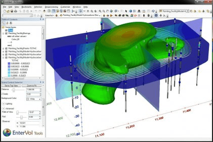
EnterVol for ArcGIS is a program designed to perform volumetric analysis within ArcGIS Desktop. EnterVol was architected from its inception to offer an easy transition for ESRI users from surface based modeling into the true 3D world of volumetric modeling.
Comments